A marine traffic map is a web-based AIS aggregator that visualizes vessel positions reported by automatic identification system transponders, and when that map goes dark, blanks vessels, or shows ghost ships from spoofing, the bridge cannot fall back on it for situational awareness. This spring brought another wave of public AIS aggregator hiccups and a measurable uptick in suspected spoofing across busy maritime regions, and bridge teams are again being reminded that the public site is a convenience, not a primary instrument. From U.S. Navy escort runs in the Red Sea to commercial sportfishing fleets running offshore canyons, the operators most exposed to AIS gaps are the ones who learned not to trust the website years ago. This post explains what actually goes wrong, why a public web feed should never sit at the center of bridge decision-making, and which onboard layers belong there instead.
What Causes a Marine Traffic Map to Go Dark?
A marine traffic map goes dark when shore-based AIS receivers lose signal, when the aggregator’s servers throttle or drop connections, or when transponders are switched off, jammed, or spoofed at scale. Each cause has different fingerprints on the bridge, and treating them as one problem is how watch teams get surprised.
In 2023, maritime intelligence firm Windward reported that more than 600 vessels showed deliberate AIS manipulation in a single quarter, and incidents in the Black Sea, Persian Gulf, and South China Sea have climbed in the years since. The International Maritime Organization’s MSC.1/Circ.1473 has acknowledged AIS integrity as a recurring concern for navigation safety, particularly for SOLAS-class vessels and for naval forces operating in contested waters. None of that traffic disappears from the water; it just disappears from a public web map.
Public aggregators rely on volunteer-run shore receivers, satellite passes from third-party constellations, and cloud infrastructure that sits behind ordinary content delivery providers. When any of those layers degrade, the map degrades with them, and the user has no way to tell which layer broke.
How AIS Aggregator Outages Differ From Onboard Failures
An aggregator outage takes the whole picture down for everyone watching the same site. An onboard AIS receiver failure is local and recoverable, and it usually triggers a clear alarm at the helm. The two should never be confused, because the response is different.
- Aggregator failure: cloud or shore-side problem, affects every operator monitoring that feed.
- Onboard failure: hardware, antenna, or NMEA bus issue, affects only your vessel and shows up on alarms.
- Spoofing event: real targets remain present but mixed with false ones, and no clear alarm fires.
- Coverage dropout: targets blink in and out as terrestrial or satellite coverage shifts.
- Class B blind spot: many small commercial and recreational craft are not on the map even when they are on the water.
Treat each of those with a different response. The bridge should never assume an empty marine traffic map means an empty sea.
Why Can’t the Bridge Rely on a Public Marine Traffic Map?
The bridge cannot rely on a public marine traffic map because the data path runs through systems no one on the vessel controls. Public maps are a useful tool for shippers, families ashore, and dispatchers, but they are not a navigation instrument and they were never designed to be one.
The U.S. Coast Guard’s Navigation Center has stated repeatedly that AIS is intended as a collision-avoidance and identification aid, not a primary navigation source. Even where AIS is mandatory under SOLAS chapter V for vessels above 300 gross tons on international voyages, the rule covers the onboard transponder, not a public website. The web layer adds latency, dependency, and a single point of failure that the bridge does not need, especially on a Navy escort run, a Coast Guard SAR sortie, or a commercial transit through a chokepoint.
There is also a quieter problem. A public map blends real-time terrestrial AIS, delayed satellite passes, and historical positions on the same view. A captain looking at that screen under pressure may not notice that a vessel ten miles ahead has not actually reported in twenty minutes. Onboard radar would not let that ambiguity survive a single sweep.
The Five Failure Modes of a Web-Hosted Bridge Display
Treating a public site as a bridge instrument exposes the watch to predictable failure patterns. Most of them are silent until the worst possible moment, which is usually close-quarters traffic at night.
- Internet dropout: VSAT, Starlink, or 5G goes quiet, the map freezes, and stale targets stay on screen.
- Server throttling: free or low-tier rate limits cap refresh, and target updates arrive late.
- Mixed-source confusion: terrestrial AIS, satellite AIS, and historical data overlay without clear labeling.
- Spoofed targets: false positions look identical to real ones inside the browser view.
- Missing classes: many recreational and small commercial vessels are not visible on public maps even when they are squarely in front of the bow.
If any one of those occurs during a close-quarters situation, the loss is not abstract. It is the difference between a clean pass and an incident report.
What Onboard Layers Should Captains Be Watching Instead?
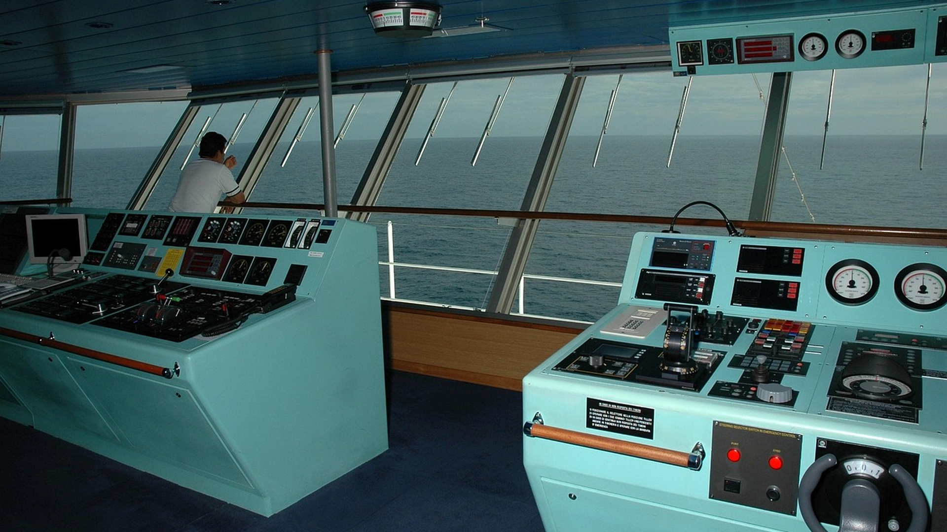
Captains should be watching the onboard radar overlay, ECDIS, the vessel’s own AIS receiver, thermal and daylight cameras, and the heading and speed instruments together as a layered picture, not a single screen. Each layer answers a question the others cannot, and together they survive what a public website cannot.
A bridge built on layered, ruggedized hardware does not depend on the internet for its primary view. Radar shows everything that reflects, not just what reports. ECDIS, mandated under SOLAS for most commercial deep-sea vessels, anchors the chart picture. The onboard AIS keeps identifying cooperating traffic in the local cell. Cameras add a human-readable confirmation. For superyacht and commercial operators, our deeper write-up on marine electronics for superyacht operations walks through how those layers are integrated on a real helm build.
How Seatronx Approaches Bridge Situational Awareness
We design and supply the displays, marine computers, and camera systems that sit at the heart of that layered picture. Our rugged marine display monitors are built for sun-readable performance, salt fog survival, and the dimming range a real bridge needs at 0300. Our fanless marine bridge computers are conformal-coated and specified to survive a 12V brownout that would crash an office machine. For radar processing and overlay work, our river radar display platforms bring tower-grade redundancy onto the bridge.
- Sunlight-readable LCDs with full dimming through to NVIS where mission-critical.
- IP66-rated bezels paired with conformal-coated boards, not stickers alone.
- Redundant DVI-DL and DisplayPort feeds so a single cable failure does not blank a console.
- Ruggedized cameras and switching that integrate cleanly with existing radar and ECDIS.
The goal is not a prettier dashboard. It is a bridge that keeps showing the truth when external services do not.
How Should a Refit Yard or Captain Plan for AIS Failures?
A refit yard or captain should plan for AIS failures the way they plan for engine, steering, or power failures: assume it will happen, build redundancy, spec hardware that does not fail with it, and train the crew to operate without it. Treat the public marine traffic map as a courtesy view, not part of the bridge.
A 2022 report from the Center for Advanced Defense Studies documented AIS gaps in commercial shipping lanes lasting from minutes to several days, depending on region and traffic source. That gap is not a freak event; it is a baseline operating condition for any vessel relying on a third-party feed. Builds and refits, whether for a U.S. Navy auxiliary, a Coast Guard cutter overhaul, or a yacht builder finishing out a new platform, should be specified accordingly.
Quick Wins for Bridge Resilience
These are the moves that pay back the fastest, in roughly the order a refit yard or captain should tackle them.
- Verify the onboard AIS receiver and antenna independently of any public marine traffic map.
- Run radar overlay onto ECDIS, not the other way around, so the chart is the anchor.
- Specify rugged, sunlight-readable bridge displays with documented IP and conformal-coating ratings.
- Add at least one ruggedized bridge camera covering the working deck and approach lane.
- Drill the watch on a no-AIS scenario at least once per voyage.
If any of those steps reveal weak points in the existing helm, that is a refit conversation. Reach out to schedule a bridge electronics consultation to scope the right hardware before the next blackout, not during it.
Frequently Asked Questions
What is a marine traffic map and how does it work?
A marine traffic map is a web service that aggregates AIS position reports from terrestrial receivers and satellites and plots them on a chart. It depends on volunteer shore stations, third-party satellite constellations, and cloud infrastructure, which is why outages, spoofing, and coverage gaps happen in the first place.
Is a marine traffic map accurate enough for bridge decisions?
No. A marine traffic map is a useful situational awareness tool ashore and a sanity check for shippers, but the bridge must use onboard radar, ECDIS, and the vessel’s own AIS as the primary inputs. Public aggregators run on infrastructure no one on the vessel controls.
What is AIS spoofing and how common is it?
AIS spoofing is the deliberate transmission of false position, course, or identity data to make a vessel appear elsewhere or pretend to be another ship. Industry monitors have logged hundreds of confirmed cases per quarter in recent years, particularly in contested waters and around sanctioned shipping.
Does the U.S. Coast Guard rely on public marine traffic maps?
The U.S. Coast Guard’s Navigation Center treats AIS as a collision-avoidance aid, not a primary navigation source, and operates its own AIS infrastructure. Public web maps are not part of the cutter or station bridge picture.
What happens to small boats that are not on a marine traffic map?
Most recreational vessels under 65 feet, and many small commercial craft, are not required to carry AIS Class A and may run Class B or no transponder at all. They will not appear on a public map even though they are squarely in your radar return, which is why radar and a forward lookout still matter.
Can a rugged marine display make AIS failures less dangerous?
A rugged marine display does not fix the underlying AIS issue, but it ensures that radar overlay, ECDIS, and the onboard AIS feed remain readable in sunlight, salt spray, and brownout conditions. That is the practical layer that keeps the bridge informed when public maps go dark.
What should a captain do when the marine traffic map shows nothing?
Treat the empty map as no data, not no traffic. Re-confirm radar returns, check the onboard AIS for active local targets, post a forward lookout, slow if needed, and continue navigating from the bridge instruments rather than the website.
Does Seatronx help integrate bridge electronics for AIS resilience?
Yes. We supply the rugged displays, marine computers, and camera systems that sit at the center of a layered bridge build, and our team can spec the right hardware for new builds, refits, or an aging helm across Navy, Coast Guard, commercial, and yacht-builder programs.